 vesseltracker.com
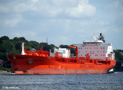
Vessel BOW FIRDA IMO: 9250751, MMSI: 257897000 Chemical/Oil Products Tanker
UTC, -23.06115, -43.11521, course: 218, speed: 0.7
UTC, -23.06147, -43.11488, course: 227, speed: 0.3
2026-01-31 01:44:02 UTC, -23.06116, -43.11541, course: 207, speed: 0
Live AIS position:
UTC. Near Santos Dumont Apt/Rio de Janeiro),
updated 2026-01-31 01:44:02 UTC.
Find the position of the vessel BOW FIRDA on the map. The latter are known coordinates and path.
marine traffic ship tracker show on live map
The current position of vessel BOW FIRDA is -23.06116 lat / -43.11541 lng. Updated: 2026-01-31 01:44:02 UTCCurrently sailing under the flag of Norway (NIS)
BOW FIRDA built in 2003 year
Deadweight:
37427 tDetails:
Last coordinates of the vessel:
UTC, -23.06148, -43.11485, course: 231, speed: 0.5UTC, -23.06115, -43.11521, course: 218, speed: 0.7
UTC, -23.06147, -43.11488, course: 227, speed: 0.3
2026-01-31 01:44:02 UTC, -23.06116, -43.11541, course: 207, speed: 0